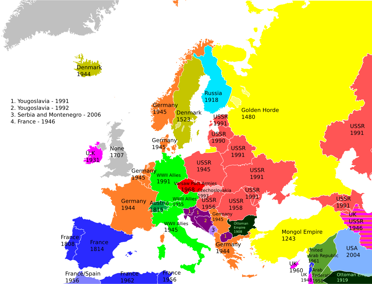
An article in Vox reproduces the above map, which is a nice presentational device showing the last year in which a European country was occupied by any power, and if so, which power.
The Republic of Ireland is indicated as being last occupied by the UK in 1931, and Northern Ireland is shown as sharing the same status as the UK which is never occupied and a year given as 1707, which
Complaints are left as an exercise for the reader.